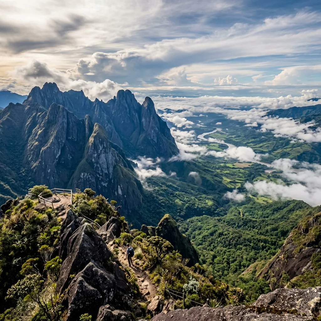
Farallones de Cali National Natural Park rises west of Cali, yet visiting it is more complicated than choosing a mountain on the skyline. Its 196,000 hectares climb from humid Pacific rainforest through sub-Andean and high-Andean forest to páramo above 3,500 metres. That range supports birds, orchids, amphibians, mammals, and the headwaters that supply communities across Valle del Cauca.
The official Farallones de Cali park page lists the park as open in 2026. A more specific December 2025 conservation notice says only three sectors are currently permitted for visitors: Pico de Loro, Charco Burbujas, and the Anchicayá canyon. Entry in the rest of the park is restricted unless Parques Nacionales publishes an explicit change.
Choose the Right Farallones Sector
Pico de Loro is the demanding summit most travelers associate with Farallones. Its approach starts through Pance and El Topacio, and entry is limited to the published morning window from 6:00 to 8:00. The park requires advance reservation through the authorized Fundación Pico Pance guides, currently between three and 30 days before the hike. Children under 12 are not permitted on Pico de Loro because of the trail's difficulty and risk.
Charco Burbujas is the other permitted Pance-side option, reached via the village, El Pato, and a trail alongside the Pance River. Its official visitor hours are 7:00 to 17:00. Do not treat the riverside recreation areas around Pance as automatic permission to enter the protected-area trail: ask where the park boundary begins, register as instructed, and stay on the authorized route.
The third permitted sector is the Anchicayá canyon at kilometre 81 of the old road to the sea, approached through Queremal and El Danubio. It currently operates only on Saturdays, Sundays, and public holidays from 8:00 to 16:00 through the named local cooperative. Peñas Blancas, La Oculta, El Manto de La Virgen, Pico de Pance, and every other unlisted sector should be treated as restricted even when an older route description still circulates online.
Getting There from Cali
Cali is the practical base, but a generic “Farallones transfer” is not enough. For Pico de Loro, official directions use public transport from Cali toward Pance followed by an approach to El Topacio, or a private vehicle through La Vorágine and the Cali-Pance road. Burbujas continues beyond Pance toward El Pato before the walk along the river. Confirm whether your guide meets you in Cali, Pance, El Topacio, or at another named point.
For Anchicayá, travel from Cali toward Buenaventura, turn toward El Carmen and Queremal, then continue toward El Danubio and the kilometre 81 operator point. The route includes unpaved roads and can take much longer in rain. Ask whether a high-clearance vehicle is needed, whether parking is supervised, and when the return transport leaves. Never assume you can finish one sector and transfer to another on the same day.
Reservations, Guides, and Entry Rules
Registration and a visitor induction are mandatory before entering national protected areas. Pico de Loro has a named authorized guide organization and an advance reservation channel, while Anchicayá lists a local cooperative. For Burbujas or Anchicayá, contact the park or current named operator before paying to confirm whether a guide, interpreter, reservation, or capacity limit applies on your date.
Ask for a written breakdown of park admission, guide or interpreter service, transport, parking, meals, and cancellation terms. Parques Nacionales recommends accident insurance, so confirm whether the provider includes a suitable policy or expects you to arrange it separately. Prices and operating arrangements can change. The park's current page is the authority, and same-week confirmation matters more than an old screenshot or informal social-media post.
A 2024 official notice documented a temporary suspension of visitor-information and control posts in Pance and Villacarmelo because of threats to park staff. The current park profile now says the park is open, but that history is a good reason to verify the operating sector, meeting point, local safety conditions, and ranger or guide presence shortly before departure.
Weather, Wildlife, and Conservation
Farallones is wet throughout the year. Lower Pacific slopes can be hot and intensely humid, while high elevations can fall close to 5°C under cloud and wind. Pack grippy footwear, light layers, a waterproof shell, dry protection for electronics, water, food, a headlamp, and a change of clothes. A clear morning in Cali does not guarantee a dry or visible summit.
The park records 626 bird species, including the Andean cock-of-the-rock, Cauca guan, multicolored tanager, and long-wattled umbrellabird. Andean bears, pumas, endemic poison frogs, orchids, and cloud-forest plants add to its conservation value. Wildlife watching should remain quiet and observational: do not use playback around sensitive birds, handle amphibians, collect plants, feed animals, or leave the marked route for a photograph.
Practical Tips
- Name the sector: Put Pico de Loro, Charco Burbujas, or Anchicayá on every booking message; do not accept an itinerary for another sector without new official authorization.
- Confirm the entry window: Arriving late can invalidate the plan even when the park is open.
- Respect age and fitness limits: Pico de Loro is not permitted for children under 12 and requires realistic preparation.
- Keep a weather alternative: Heavy rain, mud, road conditions, low visibility, or local safety measures can change or cancel access.
- Leave no trace: Camping, fires, pets, hunting, extraction of plants or animals, and entry outside authorized hours are prohibited.
Use the Farallones de Cali map entry to keep the park identity, official access source, and Cali gateway connected. A well-planned visit begins with the sector and its authorized people, not with a summit photo.
🕵️ Insider Secrets
- Ask where the paid service begins: A Cali pickup, Pance meeting point, guide fee, park admission, and parking may be separate items.
- Save the return plan offline: Mobile coverage can disappear on forest roads and trails, so keep the driver's name, meeting point, and emergency contact available without data.
- Choose birds over a forced summit: Low cloud may hide the view while making forest birding excellent. Let the guide redirect the day instead of pushing through unsafe weather.
eSIM for Colombia
Avoid high roaming fees. Get instant 4G/LTE data with Airalo as soon as you land in Bogotá or Medellín.
- Instant Activation
- No Physical SIM Card
- Local & Regional Plans